
wellQApp
A well management and groundwater research tool for multiple clients. It covers measuring points from master data and field inspections to suitability checks, reports and official data exports.
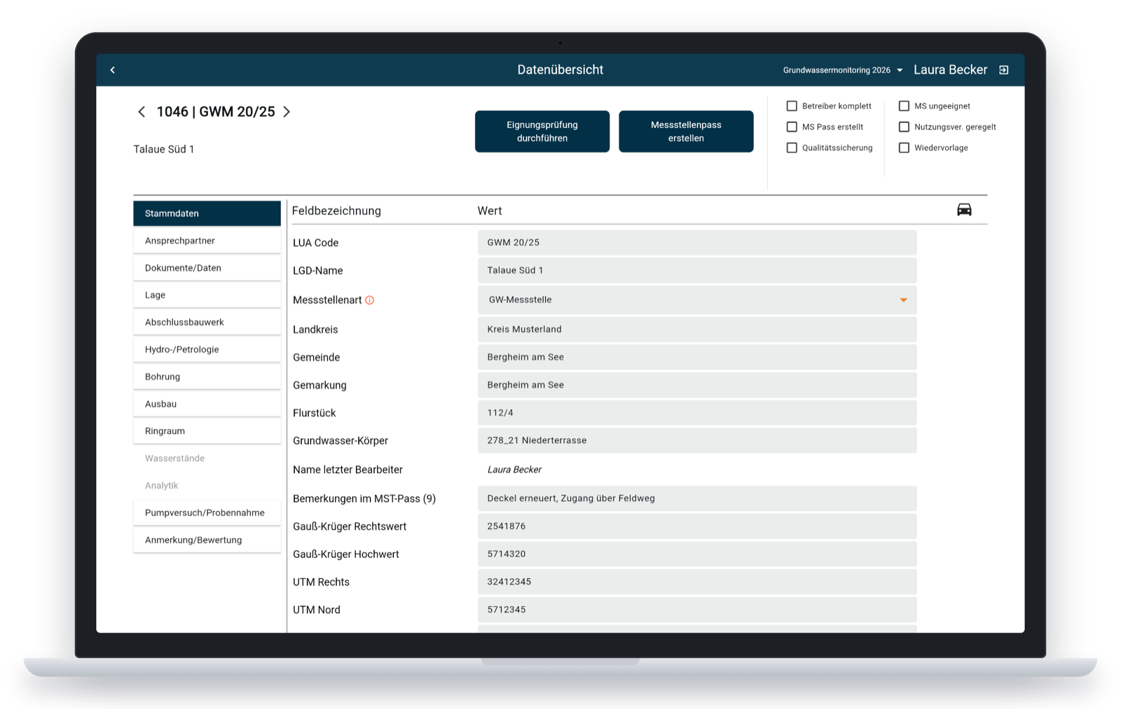
Every measuring point in one structured record.
Groundwater measuring points come with a lot of data: construction and drilling details, hydrogeology, water levels, sampling, contacts and documents. wellQApp brings all of it together in one place, so the office and the field team work on the same, validated data.
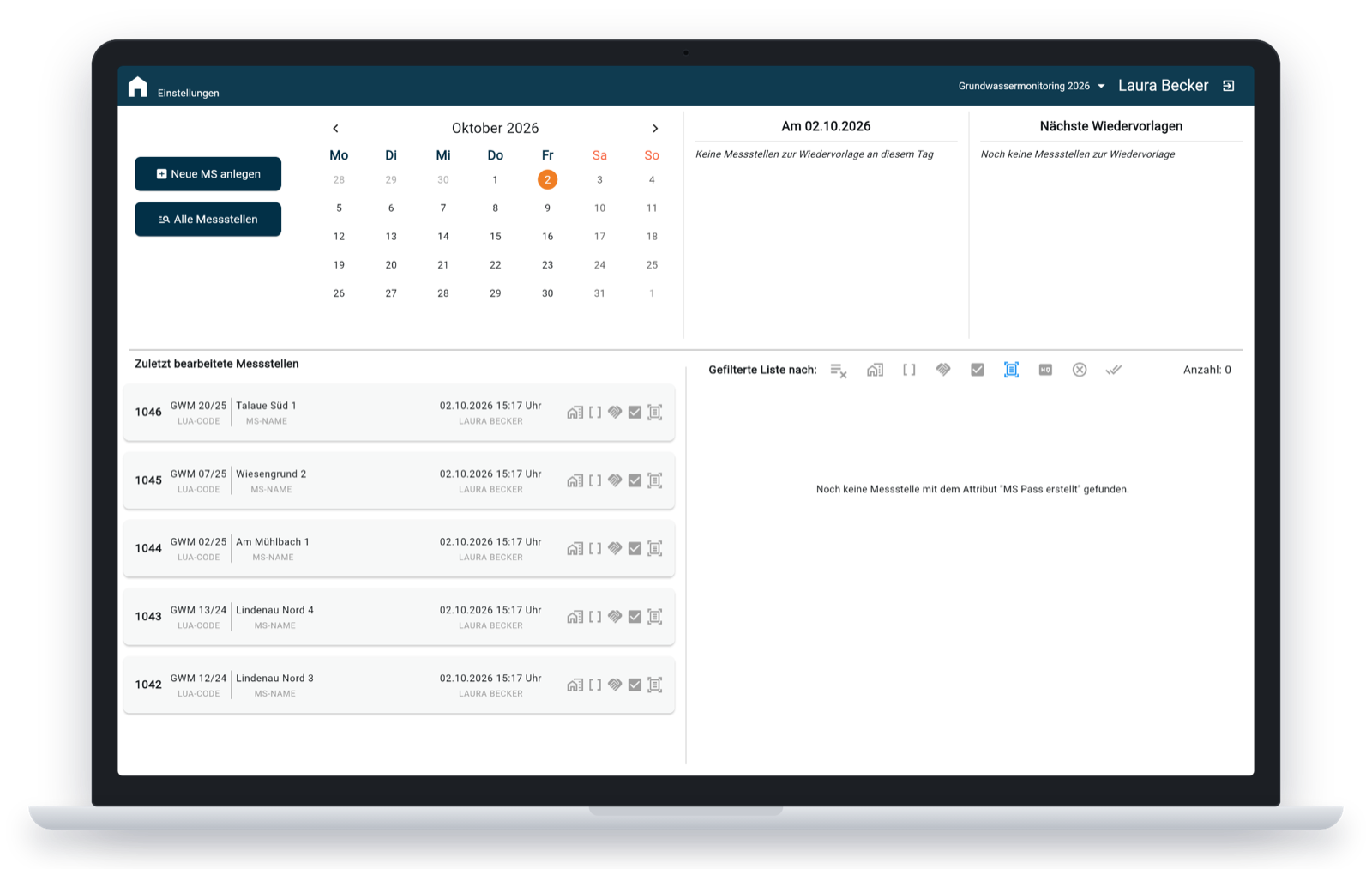
Start where the work is
The dashboard shows recently edited measuring points, follow-up dates in a calendar and filtered lists, for example all wells that still need a passport or a quality check.
What it covers
Complete well records
Thirteen sections from master data and location to construction, lining, hydrogeology, water levels, probes and analytics, with hints when required values are missing.
Suitability checks
A guided qualification of each measuring point that evaluates the recorded data and generates the matching report.
Measuring point passport
A generated passport document per measuring point that summarises its key data in one place.
Imports & exports
Excel and LANUV imports, a HygrisC master data export, and CSV, Excel and Word reports in the formats the authorities expect.
Dashboard & follow-ups
Recently edited wells, filters by operator or groundwater body, and a calendar with follow-up dates.
Documents
Uploaded files and generated documents are stored with each measuring point and always at hand.
How it’s built
Flutter for web & Windows
One codebase runs in the browser and as a Windows desktop app.
Modular packages
APIs, repositories and UI components live in separate packages, so features stay independent and testable.
Server-side documents
Cloud Functions generate the Word and Excel reports and exports, with live progress shown in the app.
Automatic backups
The database is backed up automatically every weekday evening.